


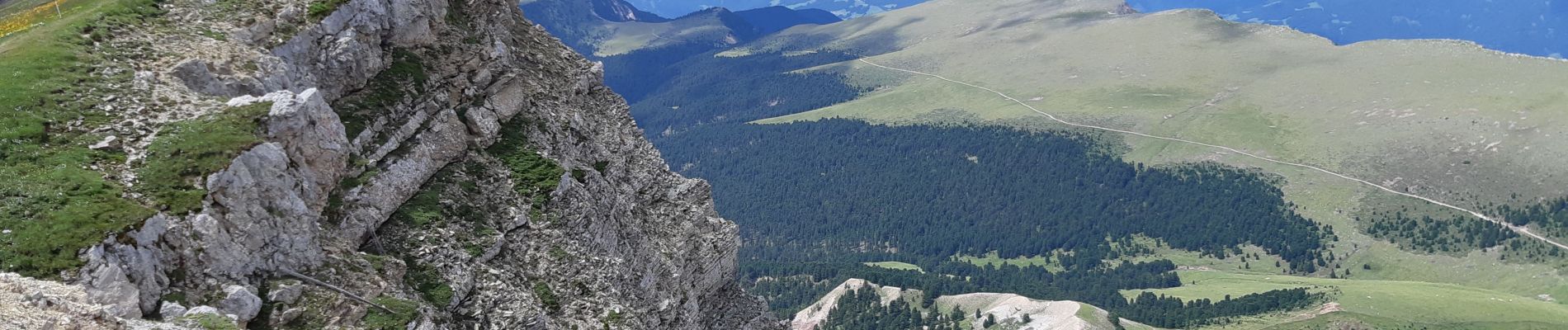
Seceda

VacheKiri67
User
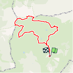

Length
9.2 km

Max alt
2509 m

Uphill gradient
465 m
Km-Effort
15.4 km

Min alt
2085 m

Downhill gradient
468 m
Boucle
Yes
Creation date :
2019-08-03 08:41:45.515
Updated on :
2019-08-03 15:04:25.26
4h53
Difficulty : Medium

FREE GPS app for hiking
 SityTrail
IGN / Geographical institutes
SityTrail Plus
The world is yours!
About
Trail Walking of 9.2 km to be discovered at Trentino-Alto Adige/Südtirol, South Tyrol, Santa Cristina Gherdëina - St. Christina in Gröden - Santa Cristina Valgardena. This trail is proposed by VacheKiri67.
Photos


99 photos in total. Please click on a photo to see them all in the gallery.
Positioning
Country:
Italy
Region :
Trentino-Alto Adige/Südtirol
Department/Province :
South Tyrol
Municipality :
Santa Cristina Gherdëina - St. Christina in Gröden - Santa Cristina Valgardena
Location:
Unknown
Start:(Dec)
Start:(UTM)
710348 ; 5162703 (32T) N.
Comments